A crucial factor in the area’s development
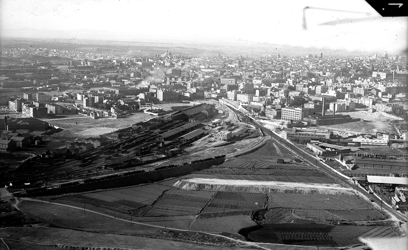
Aerial view of Madrid-Delicias Station in 1935. España. Ministerio de Defensa. Archivo Histórico del Ejército del Aire
hen Madrid-Delicias Station
started operating in 1880, it triggered an urbanisation process
in the land closest to the new railway facility, as well as
attracting industries and warehouses to its outskirts. The land
not used by the railway began to be occupied at the beginning of
the 20th century.
In the early stages of the 1930s, a large number of plots
located on the streets leading to Paseo de las Delicias and
Calle del Ferrocarril were practically occupied by residential
buildings. However, the land closest to the railway ring and the
Delicias railway facility itself was sought by commercial firms
and businesses, in order to set up their factories and
warehouses, due to the proximity of the railway line and its use
for transporting freight and raw materials. A large part of this
land would be sold by the railway companies, when it was
declared unnecessary for railway use.
The addition of railway infrastructures to the Las Delicias
neighbourhood also favoured the construction, in the surrounding
area, of large-scale industrial installations with the objective
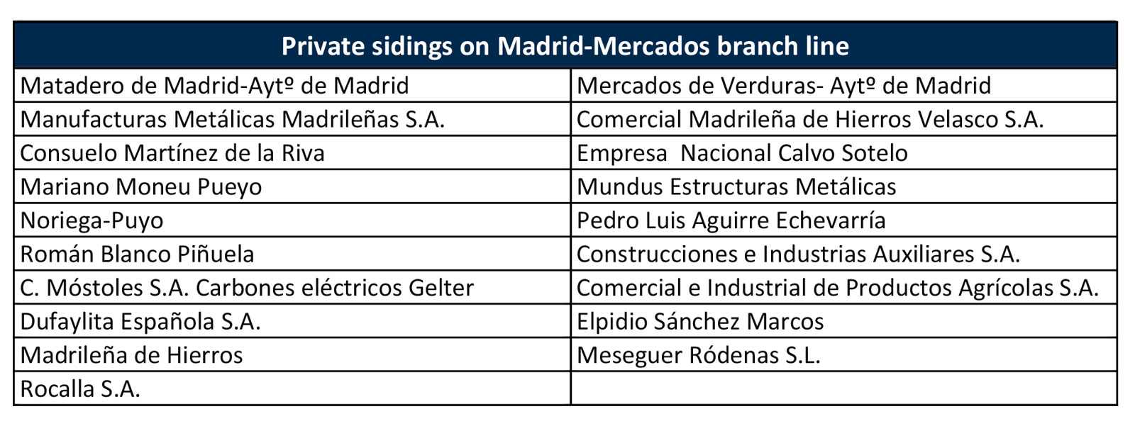
of supplying Madrid. A branch line connected Madrid-Delicias
with the Cattle Slaughterhouse and Market and with the Central
Fruit and Vegetable Market, which was attached to Madrid-Mercados
Station.
The period of the greatest occupation of industrial land in the surroundings of Madrid-Delicias was in the early 1950s. The closure of the passenger service in 1969 coincided with the beginning of a gradual deindustrialisation process, which concluded with the implementation of the urban development plan known as “Pasillo Verde Ferroviario” (Green Railway Corridor) in the 1990s.
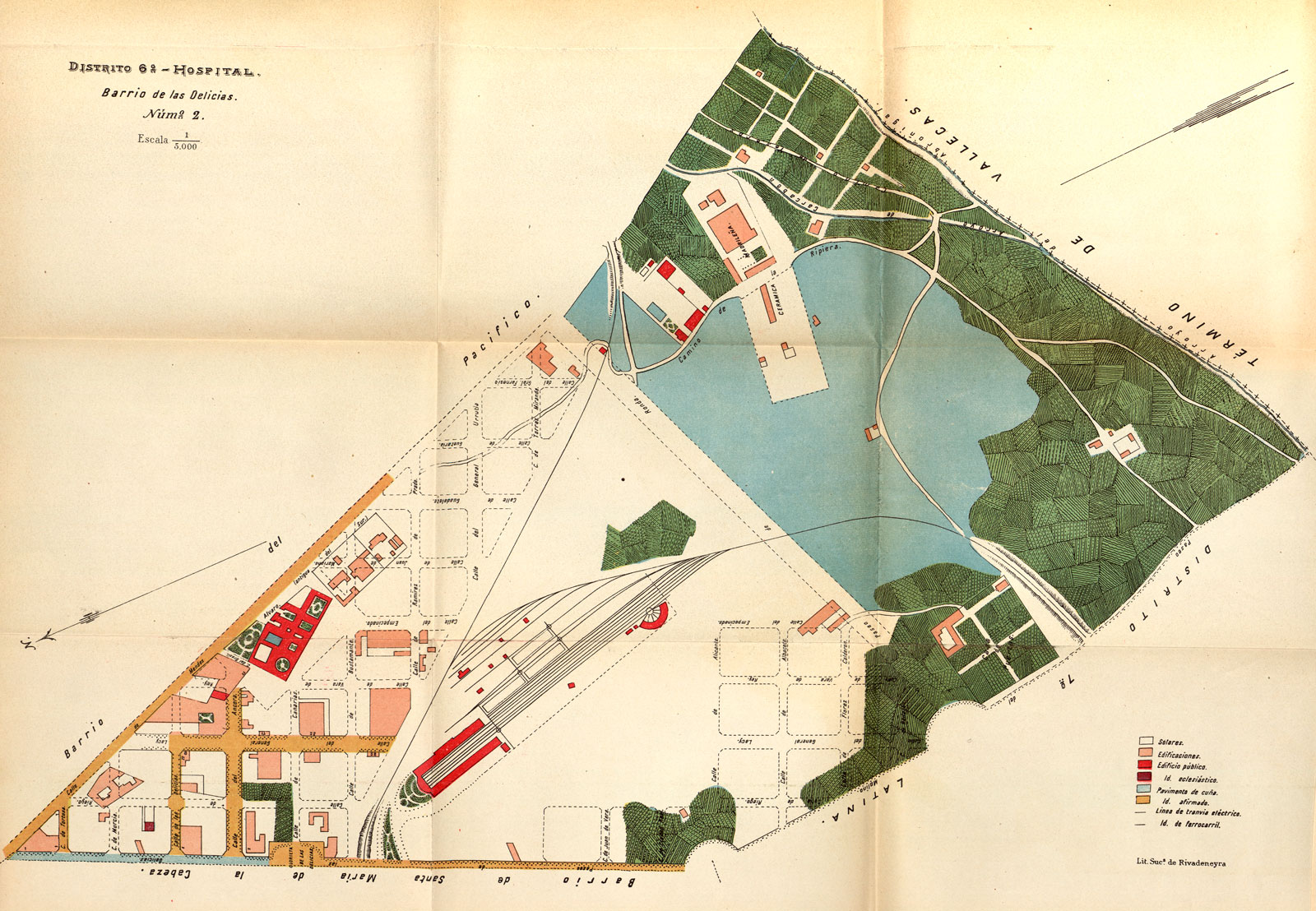
District 6, Plan 2, Las Delicias Neighbourhood. Guía práctica de Madrid. 1906. Álvaro González and Iribas. Archivo Regional de la Comunidad de Madrid
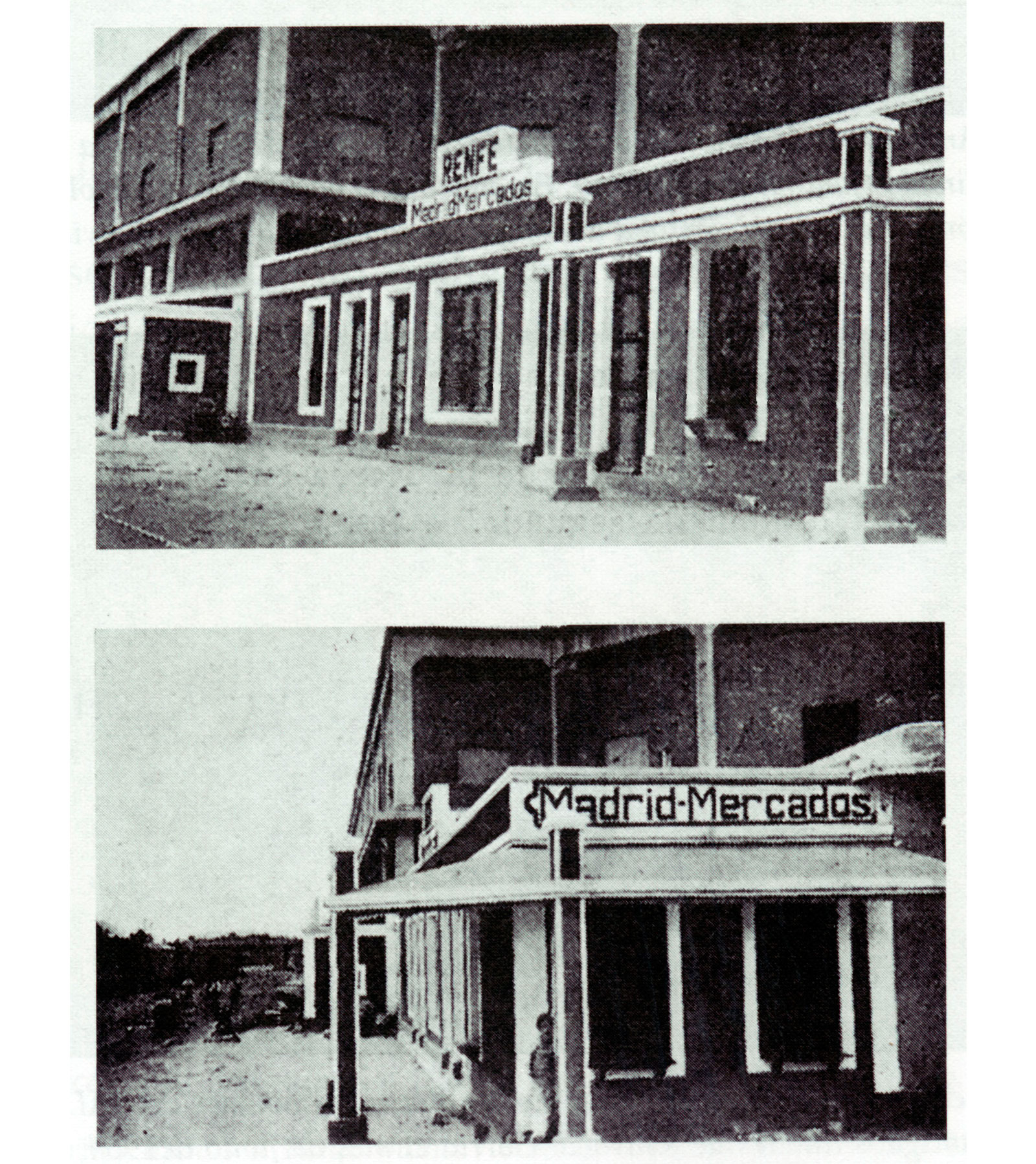
Madrid-Mercados station, on Legazpi branch line. Revista Ferroviarios. Oct-1945. BF-MFM
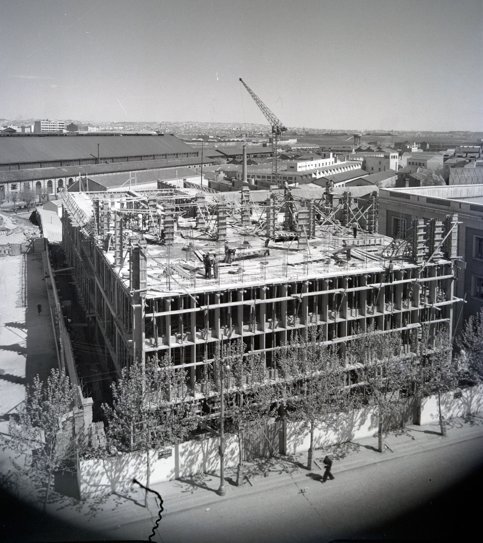
Construction of the Philips building on Paseo de las Delicias. 1954. Photo: J. Miguel Pando. The Cultural Heritage Institute of Spain (IPCE)
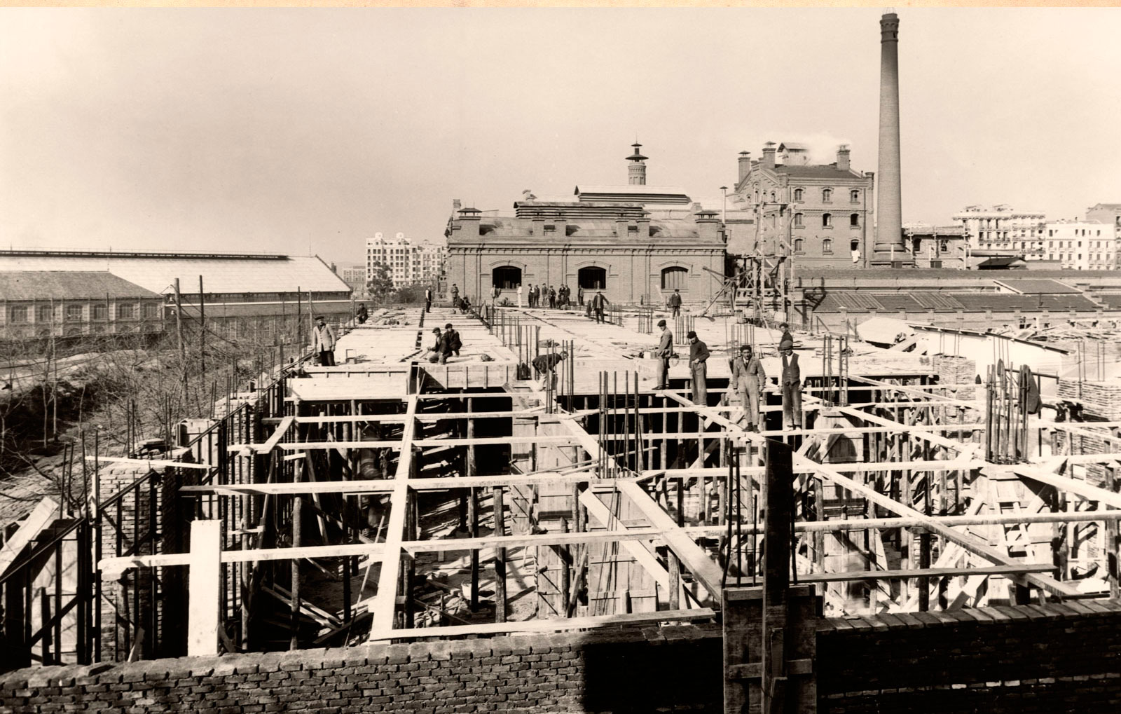
Construction of the Standard Eléctrica building. 1927. Archivo Fundación Telefónica
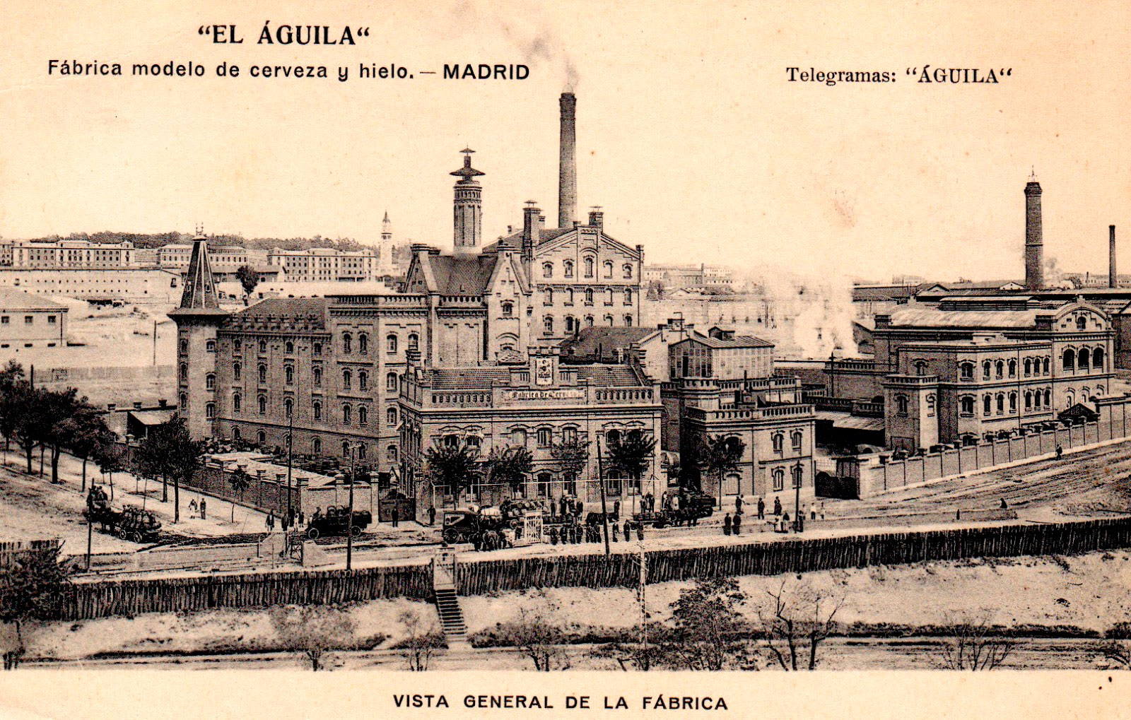
'El Águila' brewery with its own siding. 1920s. Archivo Regional de la Comunidad de Madrid
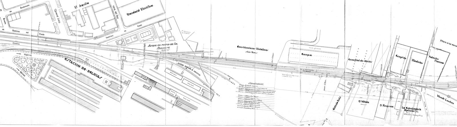
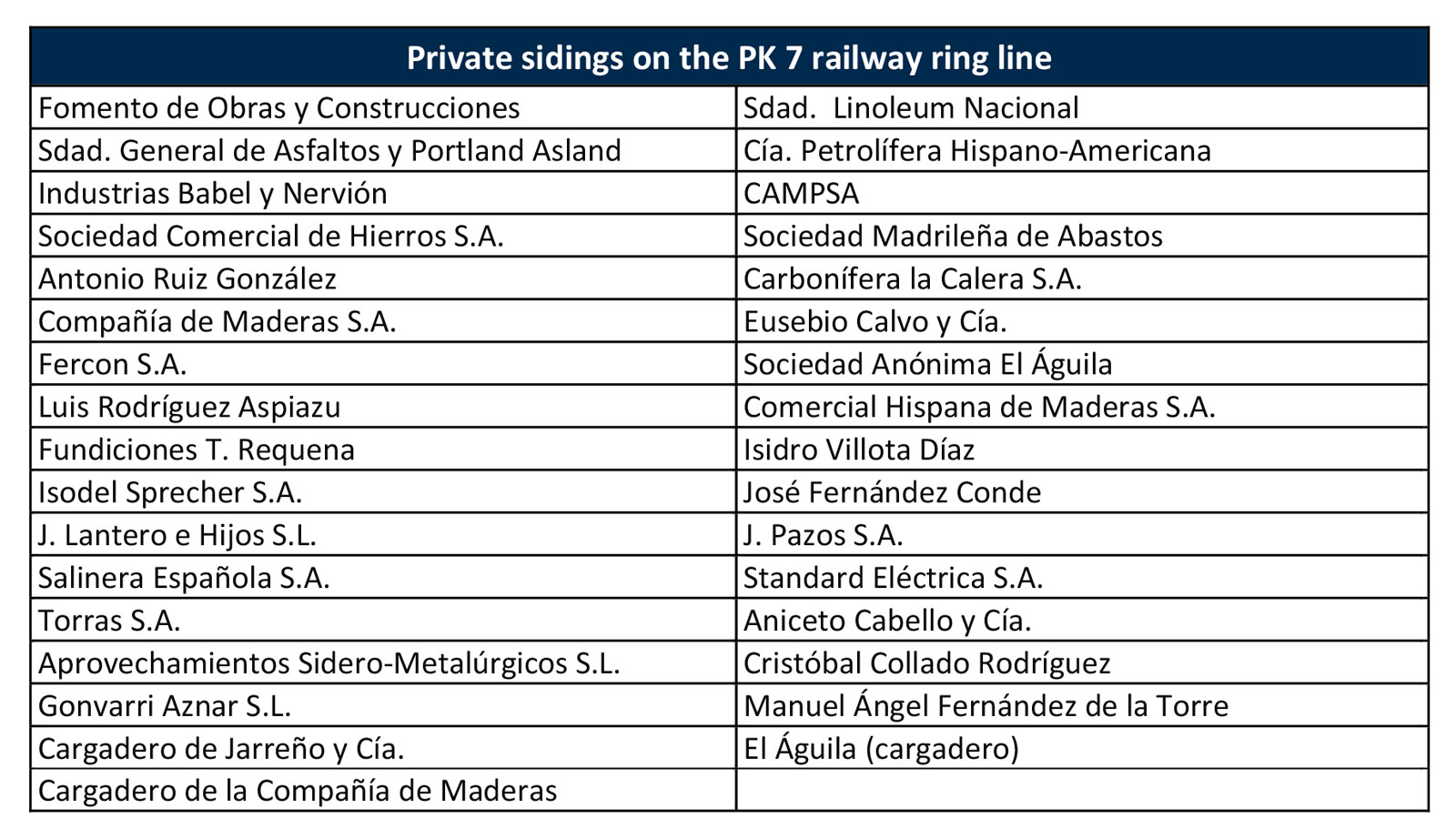
Plan of the sidings in the railway bypass. 1930s. Gerencia de Patrimonio y Urbanismo Centro. Adif
Source: Juan Peris Torner
Source: Juan Peris Torner


